Samtengang Trek


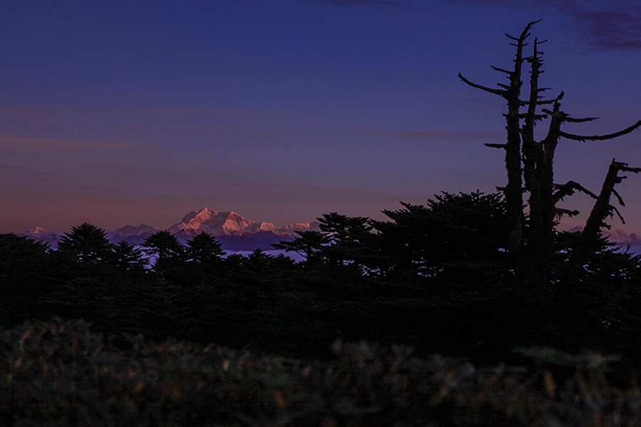
The Samtengang Trek is one of the easier lower-altitude treks in Bhutan. It explores beautiful forests, many remote historical and religious sites, and isolated villages in and above the Punakha and Wangdi Valley. Weather permitting, it also offers stunning views of mountainous peaks, including Jumolhari (7,315 m), Kang Bum Peak located above Gaza (6,300 m), and Tiger Mountain (Gangcheta, 6,840 m) north of Laya. Some of the climbs may be steep and challenging. This trek is especially recommended in winter, as there is the possibility of leeches on the trail during the rest of the year.
Day 1: Arrive At Paro Airport: Paro – Punakha
The flight to Bhutan offers breathtaking views of the Himalayas, showcasing some of the world's highest peaks. Upon arrival at Paro International Airport, our representatives will welcome you, guide you through customs, and escort you to Punakha.
Drive over the Dochu-La pass at 3,100 meters for incredible Himalayan views on clear days. In Punakha, visit Punakha Dzong, built in 1637 by the Shabdrung, situated at the confluence of the Mo Chu and Pho Chu rivers. It serves as the winter headquarters for the Je Khenpo and monks. The main temple features traditional architecture with gold and silver-adorned pillars.
Enjoy an overnight stay at your hotel in Punakha.
Day 2: Punakha – Limukha (12kms/4hours Trekking)
The trek begins upstream from Punakha Dzong, crossing Bhutan's longest suspension bridge (180m) over the Pho Chhu. The trail gently climbs on the left side of the Po Chhu through terraced fields of mustard and winter wheat. The Punakha valley, low enough for two harvests, is bustling with activity in the winter months and also produces fruits like bananas and oranges.
After a 2.5-hour uphill hike through pine forest, fern, oak, and rhododendron, there is a clearing with a big prayer flag and a beautiful view of the valley for lunch. In the distance, the huge Khamsum Yuelley Namgyal chorten is visible. To the west, the road to Dochu La can be partly traced, and with some luck, snowy peaks such as Jumolhari, Kang Bum, and Tiger Mountain may be seen.
A chorten and prayer flags at 2200m mark the end of the day's climb. From the chorten, you can see Wangdi and Limbukha, where our campsite (2220m) is located just behind the village in a beautiful green area (1.5hr).
Limbukha has several large old houses. Some say it was once a lake, and the inhabitants perform an annual ceremony related to it when irrigating the fields. In former times, a king lived here.
Day 3: Limukha – Chhungsakha (14kms/5hours)
Leaving camp, the trail climbs steeply (150m) up to a small ridge (2370m) through a cold, dense forest, where today's climb becomes visible. Cross the ridge and descend sharply into a side valley, crossing a small stream (2235m). Surrounded by birdsong and oak and rhododendron forest, follow an unclear trail covered in slippery leaves.
After about 2 hours of climbing, reach a small pass, Dochen La (2645m), adorned with prayer flags and possibly offering views of Dochu La, Jumolhari, Kang Bum, Tiger Mountain, Talo Lhakhang, and Nobgang Lhakhang down in the valley. A steep, steady descent follows along a forest trail, which opens up upon reaching Dagegon, home to a beautiful old farmhouse. In the distance, a ridge with Samtengang village and Chhuni Gompa can be seen.
Walk past Dargyel Gompa, an old monastery of Drukpa Kinley, the 'Divine Madman,' known for his unconventional teaching methods. On the hillside above the monastery are several small meditation cells.
At 1850m, reach Chungsakha (Chhungsekha), a village with a lhakhang featuring a simple but atmospheric chapel on the first floor. The monastery holds a festival every three years with masked dances and singing. The campsite is in front of the Lhakhang.
Day 4: Chhungsakha – Samtengang (13kms/5hours Trekking)
Descend to the road in 45 minutes and find a suspension bridge crossing the Bae Chhu at 1500m. The clear, moderately steep trail passes through several villages and small, deeply eroded gorges, which become very slippery when it rains. In December, the daphne flower starts to bloom.
The climb ends for the day when you pass Samtengang High School (established 1952) on your right. Walk through a narrow gorge to the other side at 2000m, and look down towards the holy lake, Lutshokha (Tsho Shokha). Continue to the campsite, 20 minutes beyond the lake, at 2050m in the forest below Samtengang village.
After lunch, you can visit Samtengang or stay in camp and enjoy the fresh wind blowing through the pines. There is a beautiful trail climbing up to Samtengang Village, where the local Gonjo Lhakhang is located, with another Lhakhang two hours above the village.
Samtengang is frequently mentioned in old literature about traveling, exploring, and plant hunting in Bhutan. It was a traditional stopping place for those traveling east-west from Wangdi. The booklet "The Ballad of Pemi Tshewang Tashi: A Wind Borne Feather" by Karma Ura provides more history of the area.
Day 5: Samtengang – Chhuzomsa- Punakha
Starting near camp, the trail today is steep and challenging. It passes through endless agricultural fields, heading into the valley of the Dang Chhu. The road will be reached next to the bridge at Tika Zam (5100ft/1555m). Overnight at a hotel in Wangdue.
Day 6: Punakha- Paro (130kms/5hours)
Drive to Paro. Visit Paro Dzong and the National Museum. In the evening, try Bhutanese beer at Namgay Artisanal Brewery. Shop for Bhutanese souvenirs in Paro town. Stay overnight at a hotel in Paro.
Day 7: Paro - International Airport
Morning: Breakfast timing may depend on the return Flight time. All hotels serve early morning Breakfast by 6.00 am.
The guests will be Seen Off by a Representative of our company and the Tour Guide at the Exit Gate. Wish Bon Voyage!!!
If you have questions about this tour or need help making your booking, we're happy to assist you. Just call +975 7763 0332 OR click Contact Us